

The Levee
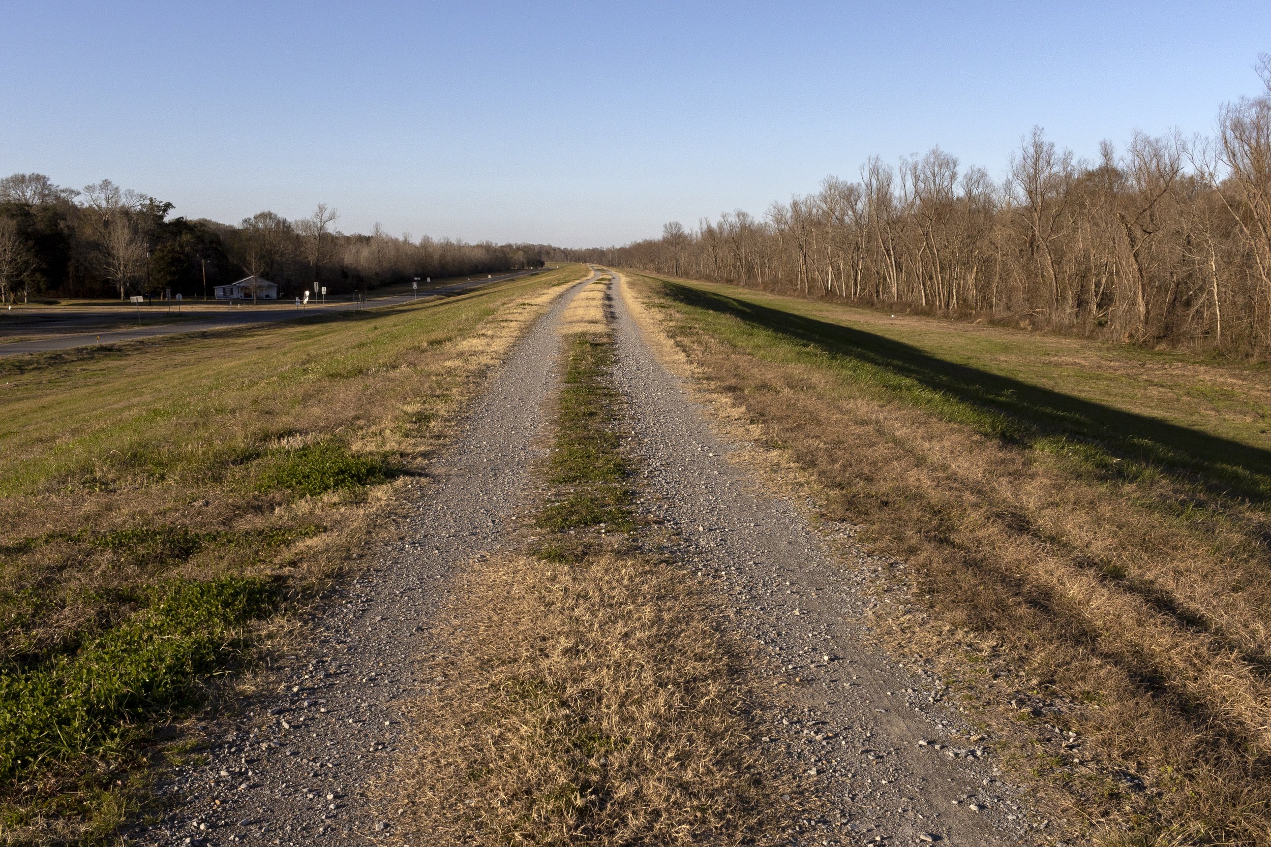
A giant earthen wall runs right through St. Martin Parish, dividing it down the middle. It’s a sight to behold, this huge ribboning mound of earth, grass and gravel, fifteen feet tall, snaking through the landscape for miles. It wasn’t designed to be beautiful or profound—it was designed to serve as a barrier—yet with its graceful essing curves and fortress-like dimensions, it’s easily one of the parish’s most iconic geographic features. The official name of this marvel of civil engineering is the West Atchafalaya Basin Protection Levee. Around here, we just call it the levee.

The levee road near Butte La Rose
You can draw a straight line back in time from the levee to The Great Flood of 1927. At the time, The Great Flood was the worst peacetime disaster in the nation’s history. Much of the Lower Mississippi River Valley, including most of southern Louisiana and all of St. Martin Parish, was underwater. Over 600,000 refugees, my great-grandfather’s family included, had to seek temporary shelter in Red Cross camps near Lafayette until the floodwaters receded. The magnitude of devastation shocked the country.
In response, the Army Corps of Engineers decided to go big and begin construction of two massive earthen protection levees, one down each side of the Atchafalaya River, all along its course from its origin at the Mississippi to its delta at the Gulf of Mexico. The East Atchafalaya Basin Protection Levee, ninety miles long, and the West Atchafalaya Basin Protection Levee, seventy-four miles long, were formed by dredging large channels through the southern Louisiana landscape, reforming the earth into two massive ribboning mounds that paralleled the course of the Atchafalaya. The Atchafalaya Basin Floodway was born.

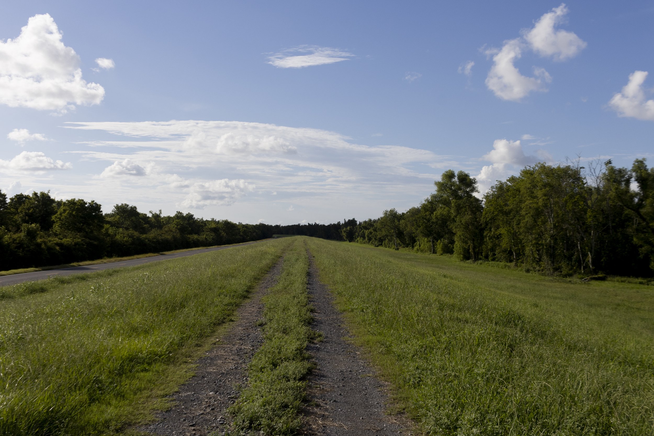
The levee near Catahoula boat ramp
The idea was to transform the ill-defined and porous boundaries of the Atchafalaya Basin—a vast flooded forest nearly a million acres in extent—into a neatly bounded floodway. If the Mississippi River Basin is a huge funnel funneling water from all across North America down into the Gulf of Mexico, you can think of the Atchafalaya Basin Floodway as one of the spouts of that huge funnel, a fifteen-mile-wide spout with water-tight walls thanks to those two massive levees.
It was an enormous undertaking, requiring tens of thousands of man-hours throughout the 1930s. The son of one of the men hired to help build a section of the levee between Catahoula and Henderson provided me with a payroll from the project. It shows that for two weeks in 1932, at the height of the Great Depression, over fifty men worked in ten-hour shifts, sometimes six days in a row, shoveling dirt under back-breaking conditions for thirteen cents an hour. I’m told they were grateful for the work. The levee has been holding ever since.

1932 Payroll from construction of the levee
The paradox of a levee, which is true of any wall, is that it protects but it also separates. In fact, there can be no protection without some form of separation. And so it’s reasonable to view the levee as both a savior and a scar.
Before the levee was built, scattered communities throughout the Atchafalaya Basin were all interconnected through a network of canals and waterways. For example, you could get in a boat in Catahoula or Henderson and end up in the Atchafalaya River winding through Butte La Rose, or even down to Bayou Benoit or Bayou Chene. It was an ever-changing landscape of earth and water. People lived in communion with the natural resources of the great swamp, but they were also extremely vulnerable to seasonal flooding.

The levee near Butte La Rose
After the levee was built, things were more black and white. Now you were either on this side of the levee or that side of the levee. Henderson and Catahoula prospered. Outside of the floodway people no longer had to build their houses up on pilings. Outside of the floodway land could be reliably farmed. Schools and churches could be built. Communities inside the floodway did not fare as well. What little remained of Bayou Chene after the Great Flood was soon buried under twelve feet of silt.
The levee is too massive to take in all at once. The best way to experience it is to go for a drive down the long levee road on a sunny spring morning when the levee is covered in wildflowers, and the wildflowers are covered in dew. You can go all the way from the boat landing in Henderson to the state park at Lake Fausse Pointe without any stoplights or stop signs, just one long ribboning road.
The levee near Bayou Benoit
The levee road today is beautifully maintained, and it makes for a nice winding drive, but I’m old enough to remember when there was no levee road at all. If you wanted to get from Catahoula up to Henderson or down to Bayou Benoit you had to drive literally on the levee. The conditions were never great up there, and practically impassable after a storm, but there was always the thrill of driving over the two big humps in the levee where the pipelines tunneled under.
The old gravel road is still there, now almost a hundred years old, one long stripe of grass growing up between the tire tracks, earth sloping down either side. It’s closed to traffic, but if you should ever find the occasion to drive up one of the ramps—maybe you’re crossing over from Red’s Levee Bar to the boat landing on the other side—I recommend pausing for a few seconds at the top of the levee before you drive back down. Take a good look down the long gravel road winding toward the horizon. Take a good look at that massive mound of earth and imagine what used to be.