

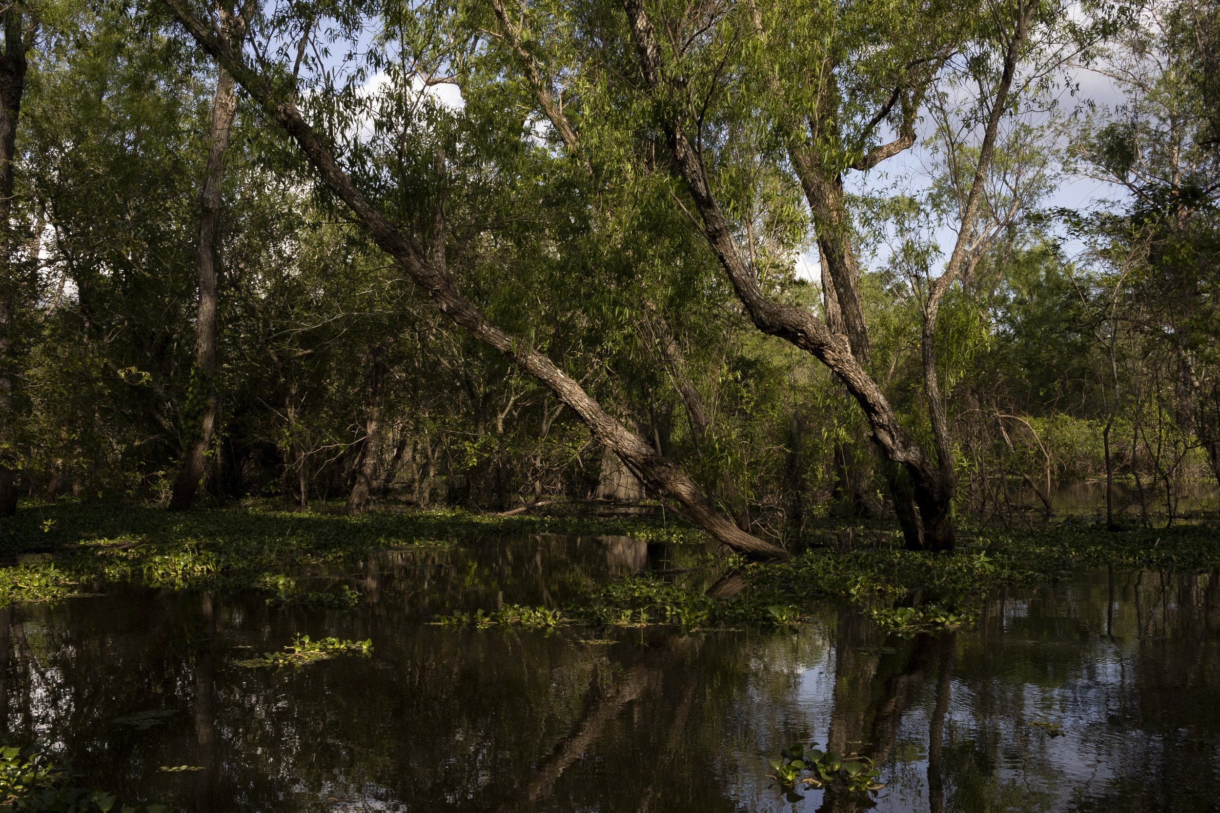
Indian Bayou
Deep in the flooded forests of Indian Bayou, far from any sign of human activity whatsoever, it’s easy to step into the past and imagine what the Atchafalaya Basin must have been like when it was at its wildest. Not to be confused with the other Indian Bayou—a community in Vermilion Parish on the other side of Maurice—the Indian Bayou Area is a 28,500-acre wilderness area located in the heart of the Atchafalaya Basin. Owned and managed by the U.S. Army Corps of Engineers, it was established in 1995 to preserve the natural environment, its native plants and animals, and to provide public access for hiking, hunting, boating and fishing. The vast area straddles St. Martin and St. Landry parishes and encompasses the stretch of the Basin between the Atchafalaya River and the Henderson Levee Road north of interstate 10.

Oxbow Lake
There are several points of access to Indian Bayou Area, depending on whether you want to enjoy the area by boat, kayak, bike or foot. Oxbow Lake is my favorite place to kayak. It can be accessed from the Oxbow Parking Area. From Interstate 10, exit at Butte la Rose (Exit 121—Atchafalaya Welcome Center) and follow the levee road north approximately five miles. The clearly marked parking area will be on your right. There’s a limestone parking lot by the levee, and you are welcome to park there, but if you want to get your kayak closer to the lake, there’s a gravel road leading away from the parking lot. That will get you to the launch. You can unload your kayak there.
Oxbow is the term for a horseshoe-shaped bend in the course of a meandering river. Over time, as a river meanders, an oxbow can become pinched off from the river as the river seeks a straighter course, leaving a curved lake behind. Less than a half mile in length, the parenthesis-shaped Oxbow Lake is the remnant of an earlier meandering of the Atchafalaya River. Now it’s completely cut off from the river, standing alone as an isolated body of water, except when the water in the Basin is high during the spring and summer, and a small, shallow connection re-emerges between the north end of the lake and the Atchafalaya River.

Yellowtops in bloom
The boat launch isn’t built for motorboats to access. It’s only a narrow dirt path sloping down to the edge of the lake, so the only boating you can do there is with a canoe or a kayak. There’s never a very strong current, and there’s always a good chance you will have the entire lake to yourself. In spring, yellow wildflowers sprout up from every visible surface. In summer, all is green. Catfish jump. Ibises fly low overhead, whooshing. A palpable sense of timelessness. Tie your kayak to a tree at the northern end of the lake and climb onto the thin strip of land that separates the lake from the Atchafalaya River. But be careful. Those whorls in the tall grass and wildflowers may be alligator nests.

Indian Bayou
If you would prefer to enjoy the Indian Bayou Area by foot, there are thirty-five miles of scenic trails, thirteen of which are designated specifically for hiking. The most popular hiking trails can be accessed from the Indian Bayou Parking Area. From Interstate 10, exit at Butte la Rose (Exit 121—Atchafalaya Welcome Center) and follow the levee road north approximately five and a half miles. The clearly marked parking area will be on your left. From here, you can hike the one-and-a-half-mile-long Alligator Trail, or, my favorite, the Indian Bayou Loop, a three-mile-long grass foot-trail that follows the course of Indian Bayou as it winds, green and primeval, deep into the swamp forest.

Indian Bayou hiking trail
Imagine an ancient forest of old-growth trees, muscular vines, undisturbed, grown woody over the centuries, and a foot-path winding through it, woodpeckers echoing through the cottonwoods. The trails are unpaved, and depending on when you visit, there may be tall grass, so be sure to wear closed shoes at the very least. If you’re feeling adventurous, wear rubber boots. That will open up more areas for you to explore. You will probably see a snake, an alligator or a deer. On some visits, I managed to see all three. The trails are so out of the way, it’s unlikely, but you may even encounter a bear. Hike with a buddy, bring plenty of water, and please remember that certain areas of Indian Bayou are designated as hunting areas, so hikers are encouraged to wear hunters safety orange during all hunting seasons. For your safety, take a moment to familiarize yourself with hunting season dates before planning a hike. A map of the hiking trails can be found here.

West Dixie Landing
If you would prefer to explore by motorboat, there’s a public boat launch on the western edge of the Indian Bayou Area, which is accessed from the West Atchafalaya Protection Levee. From Interstate 10, exit at Henderson (Exit 115) and take Highway 347 south. Immediately turn left onto Highway 352 and head east for two and a half miles until the road ends at Pat’s Fisherman’s Wharf. Take a left on the levee road and drive four miles north to the West Dixie Landing, which will be on your right. There’s a parking lot, a restroom and a well-maintained boat launch here.
From the landing take the access channel, which is a straight shot into the heart of the Basin and Henderson Swamp. Be mindful, and be prepared. The way the bayous twist and turn, they aren’t always intuitive to navigate. You can also explore the area by kayak. A variety of waterways branch off of the access channel, including Bayou Fordoche, Bayou Fusilier and twenty-four miles of officially designated paddling trails. Far from the sound of any car traffic, you are immediately immersed in the sights and sounds of the flooded forest—woodpeckers, ibises, bullfrogs, ducks, etc.—with lots of shaded areas and narrow canals that open up into small bays.
