

Henderson Lake
A hundred years ago there was no Henderson. The land that would become Henderson was still fully within the floodplain of the Atchafalaya River then, and what was to become the body of water that today we call Henderson Lake was a vast shoal at the western extent of the Atchafalaya Basin, a broad, shallow depression lushly forested with cypresses, always somewhat wet, sometimes mostly dry, often underwater, and shifting from season to season at the mercy of the unruly river.

Henderson Lake
The entire western edge of the Atchafalaya Basin, from Henderson down to Catahoula and beyond, was porous, intricately raggedy and impossible to predict, the ground very much in flux. Then in the early 1930s the protection levees came carving through—two massive earthen walls, one down each edge of the Basin—and where once was a porous border between swamp and solid ground, there now was an impenetrable barrier. That’s where Henderson first appeared, in the shadow of that massive levee.
On an 1891 map of the great swamp, it was just a bunch of squiggly trees with the words OAK, ASH, GUM & CYPRESS written vertically beside them. You can see Lake Bigeaux and Lake Pelba scribbled in and left unlabeled. You can see Bayou Portage, Butte La Rose and Breaux Bridge on the map. But you can’t see Henderson yet. On a 1901 map you can see a stretch of Southern Pacific Railroad spanning the Atchafalaya Basin.

1891 Map
And on a 1935 map of the great swamp, you can see the town of Atchafalaya, a station on the stretch of Southern Pacific Railroad that once spanned the Atchafalaya Basin. Still no Henderson. Then on a 1940 map, the town of Atchafalaya has disappeared, at that point pretty much a ghost town, and now you can see there’s a New Henderson Landing, with one long gravel road dead-ending at the levee.
So Henderson is quite young. It only became incorporated in 1971, two years before the completion of the Basin Bridge, when the two-square-mile town suddenly found itself as a kind of station on the twentieth century’s answer to the railroad—Interstate 10—as it enters the Atchafalaya Basin. Which is how most people know Henderson today, as the last exit before driving onto the Basin Bridge, an eighteen-mile-long bridge that spans the Atchafalaya Basin, third longest bridge in the country.

Henderson Bridge
Today Henderson enjoys a reputation for fresh seafood, Cajun cuisine, live music and high-energy dancing. It’s been that way since 1934, when Henry Guidry moved his seafood restaurant from the nearby farming community of Lenora to start a business near the new landing, essentially putting Henderson on the map. Then in the early 1950s, Pat Huval and his wife Agnes bought the old Guidry restaurant and dance hall and sold it to buy the building on Bayou Amy that would become the world-famous Pat’s Restaurant, setting into motion, and providing the perfect venue for, the heyday of Cajun cuisine. There at that end of that unlikely gravel road, it could even be argued, was where crawfish first crawled out of the swamps and into the national spotlight.

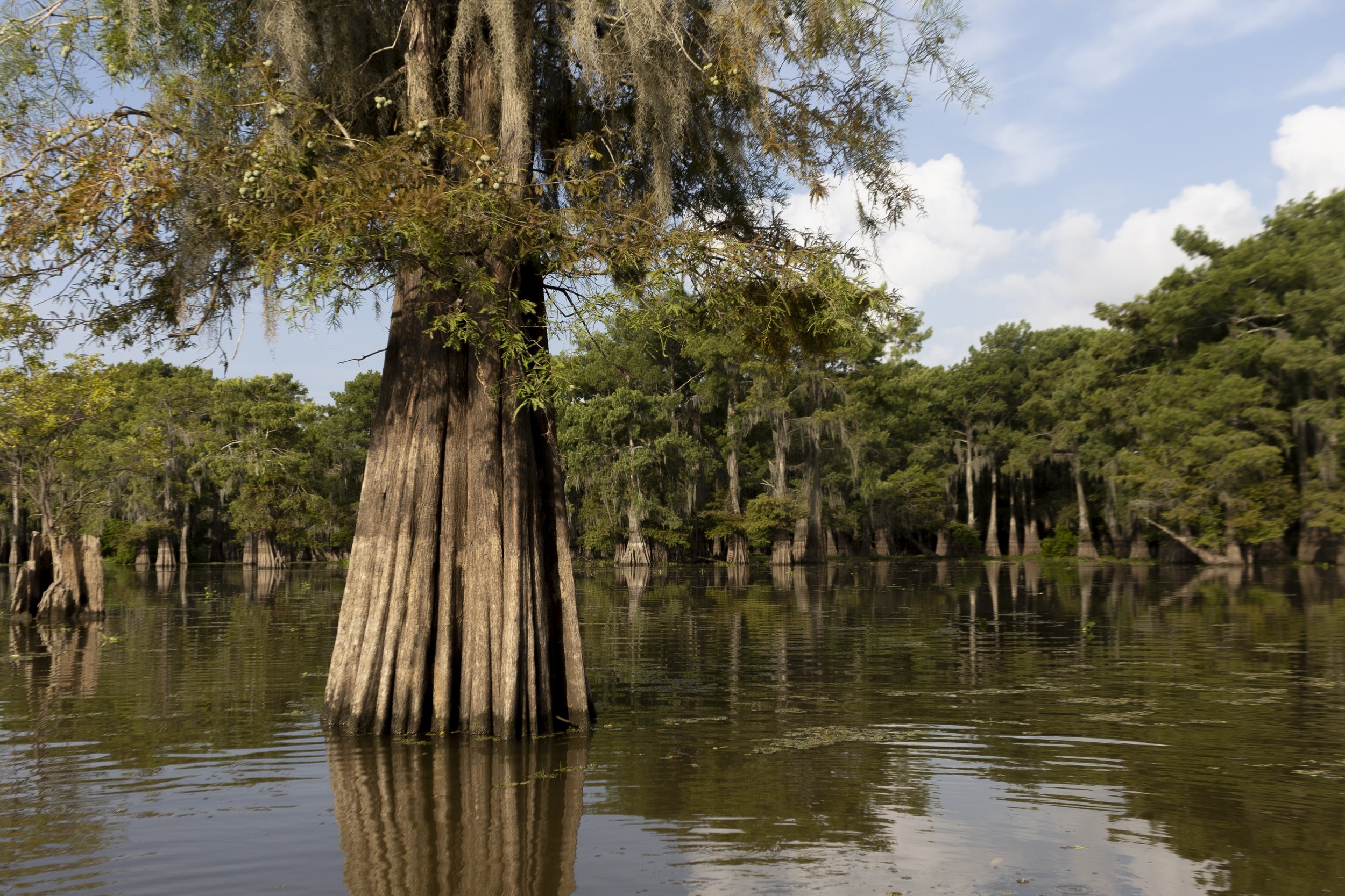
Henderson Lake
Henderson Lake is the large body of water you see as you’re driving across the Basin Bridge heading east from Henderson. It’s also called Henderson Swamp. You’ll notice that there are hundreds of cypress trees—some half-harvested, some still alive—poking up from the surface of the water. What you may not realize is that this iconic lake is man-made. Construction of the levees blocked the natural drainage of the area, permanently flooding the primeval forest. Using a control structure in the outlet channel, the depth of the lake, typically nine feet above sea level, can be maintained with some precision, although during wetter season the lake can be easily twelve or more feet deep. When invasive aquatic plants threaten to choke off access to the lake or alter the biology of the ecosystem, water levels can be drawn down to a depth of six feet to combat the invasion. A drawdown is scheduled for this August.
What you also may not realize, driving across the Basin Bridge, is that none of those flooded trees will ever reproduce. Cypress trees grow well in water; they continue to grow branches and produce cones; they can even live as long as three or four hundred years; but without dry ground for their seeds to take root in, their cones will forever be in vain; they’ll leave behind no cypresses to replace them. When you learn to read the landscape, in addition to whatever beauty you find there, you see it for the elegy it is. A lake where a forest used to be. The squiggly trees on the map, the words OAK, ASH, GUM & CYPRESS written vertically beside them, those trees are forever underwater. And those trees still standing disappear every year.
