

Catahoula Lake
A hundred years ago Cata-Oulou was its own little lake in the larger labyrinth of the Atchafalaya Basin, fed by a small bayou that came in from the east, and one long coulée that came in from the west, but otherwise relatively isolated.
With its almost-straight-down banks and seemingly bottomless depths, the lake stood out from its surroundings. Bodies of water in southern Louisiana are typically shallow, muddy depressions. Cata-Oulou was two miles long and a hundred feet deep, with weirdly clear waters—a crystalline gash in the wetland landscape. And the colorful legend that became attached to its creation only added to its mystique.

Steep banks of Catahoula Lake
One day, the story goes, the earth cracked open without warning, swallowing an entire encampment in a single gulp, the yawning canyon filling at once with water the transparency of crystal. They called it Cata-Oulou—lake of sacrifice. Water so violently born, so bottomless, so burbling with blue crabs and catfish, could all mean only one thing. The lake was a gift from the gods.
The area around the sacred lake was home to the Chitimacha, and pottery shards attest to the presence of human inhabitants for at least the last twelve hundred years, but seasonal flooding from the sprawling and unpredictable Atchafalaya prevented the construction of more permanent dwellings until protection levees were built in the 1930s. French-speaking fishermen and farmers, lured by fertile farmland and the natural resources of the Basin, settled near Cata-Oulou, putting down the roots of a small community that would come to be called Catahoula Lake.

Crawfish Boil
Not to be confused with the much larger lake of the same name in central Louisiana—that Catahoula Lake is the state’s largest freshwater lake—and not to be confused with Catahoula Parish, which is a totally separate place, this Catahoula Lake is a two-mile-long lake in eastern St. Martin Parish, at the western edge of the Atchafalaya Basin.
While it retains much of its original splendor, especially the muscadine-draped bayous at its southern end, after the protection levees came carving through the Basin, the little lake was no longer an isolated body of water. It had become just another link in the long network of waterways that drains parts of Texas, Oklahoma, Arkansas and northern Louisiana, a conduit for large volumes of water going from the Red River to the Gulf of Mexico.

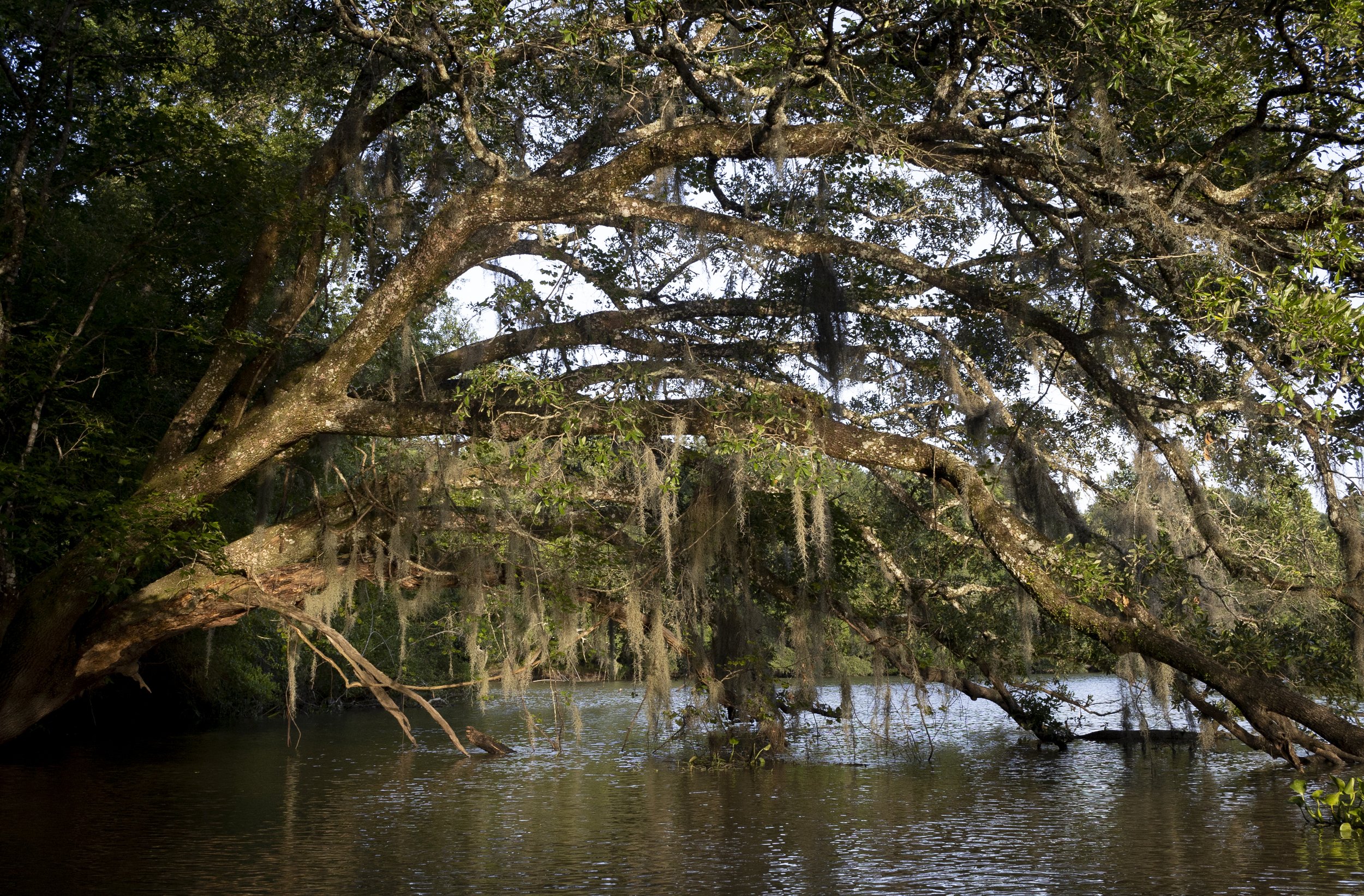
Muscadine-draped live oak
With water comes sediment, and as a result of all this wash-through, Catahoula Lake has been silting up. Crabs are no longer caught there, the water isn’t as clear as it used to be, and the lake, once reputed to be a hundred feet deep, the bottom of it beyond the reach of even the most able diver, is now so shallow in places that small islands can be seen poking up through the surface of the water.
Fortunately, the St. Martin Parish public works department began a dredging project in the spring of 2022, with the goal of restoring some depth to the lake. A thirty-five acre pit surrounded by a seven-foot levee has been constructed on a nearby island, ready to receive the dredge spoils once the pipeline from the lake has been built. It will never be what it used to be, but efforts by the parish will help preserve this little lake, the life-blood of tiny Catahoula.

Boat landing in Catahoula Park
Catahoula Lake and surrounding bayous are popular with fishermen and boaters year-round. The only public boat launch in Catahoula is at Clayton Boudreaux Memorial Park. If you head south from the boat launch, the lake forks into a network of bayous and small islands. Or head north, go under the bridge, and in a quarter of a mile you’ll see the cut to Bayou Mercier on your right. If you heading north, you’ll find yourself in the belly of the narrow lake. Continue for another mile and a half, and the lake will bend to the west to become Bayou Berard.
